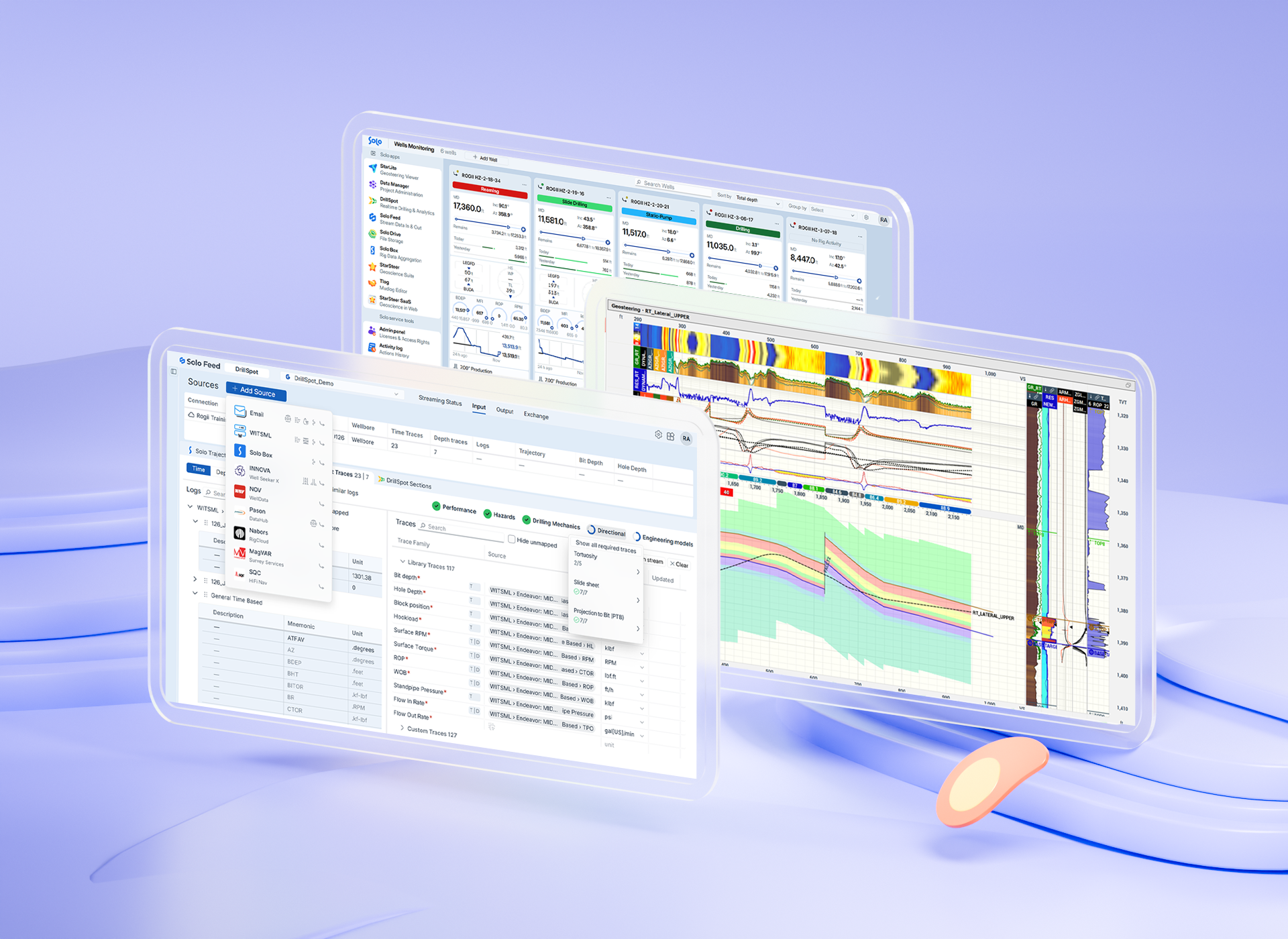
Real-Time Geological Operations
Accelerate decision-making in geological operations with Solo Cloud. Field information flows into unified workflows and role‑based views, so teams collaborate on the same live picture of the well across devices, no matter where they are.
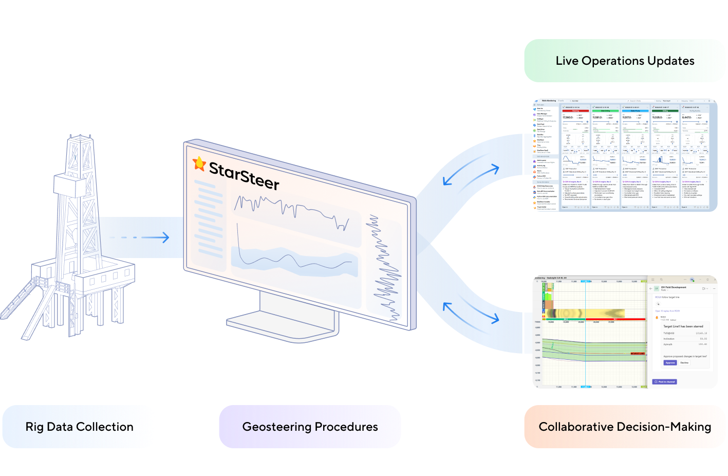
Rig Data Collection and Automation


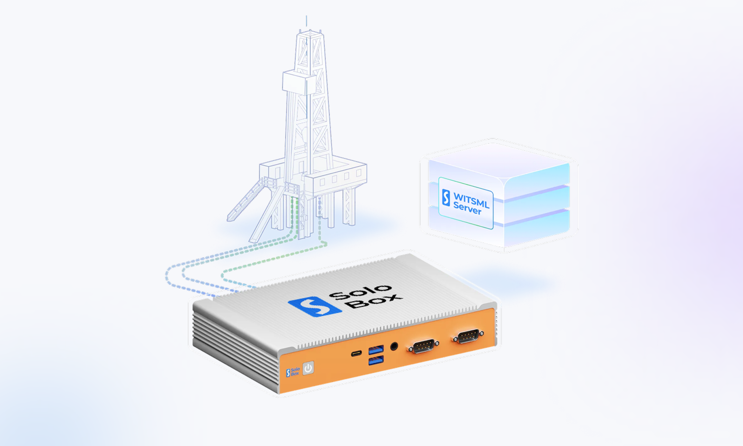
Solo Box is ROGII’s hardware solution for real-time drilling data, aggregating WITS0 from every vendor at the rig into a clean, compressed WITSML stream.
Features:
- Less than 1 second data aggregation intervals
- Flexible rig-site connectivity
- Integration with major EDR systems (Pason & NOV)
- Remote web-based Solo Box management
- Configurable multi-protocol data input (COM, TCP)
- Data output & job management to WITSML
- WITS mapping engine with templates & mnemonics
- 24/7 technical support provided
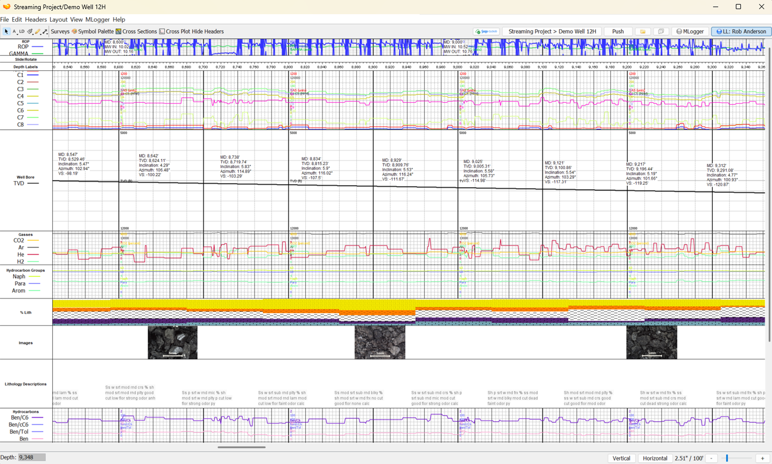
TLog is a cloud-enabled mudlogging application for oil & gas operations. Quickly build and export logs and lithology reports in multiple file types. Push mudlog data directly to Solo projects to collaborate in real-time.
Features:
- Vertical & horizontal mudlogs
- Template customization
- Multi-format data import
- Customizable track visualizations
- Lithology text export
- Stream logs from folder
- Sync with Solo projects
- High-quality export options
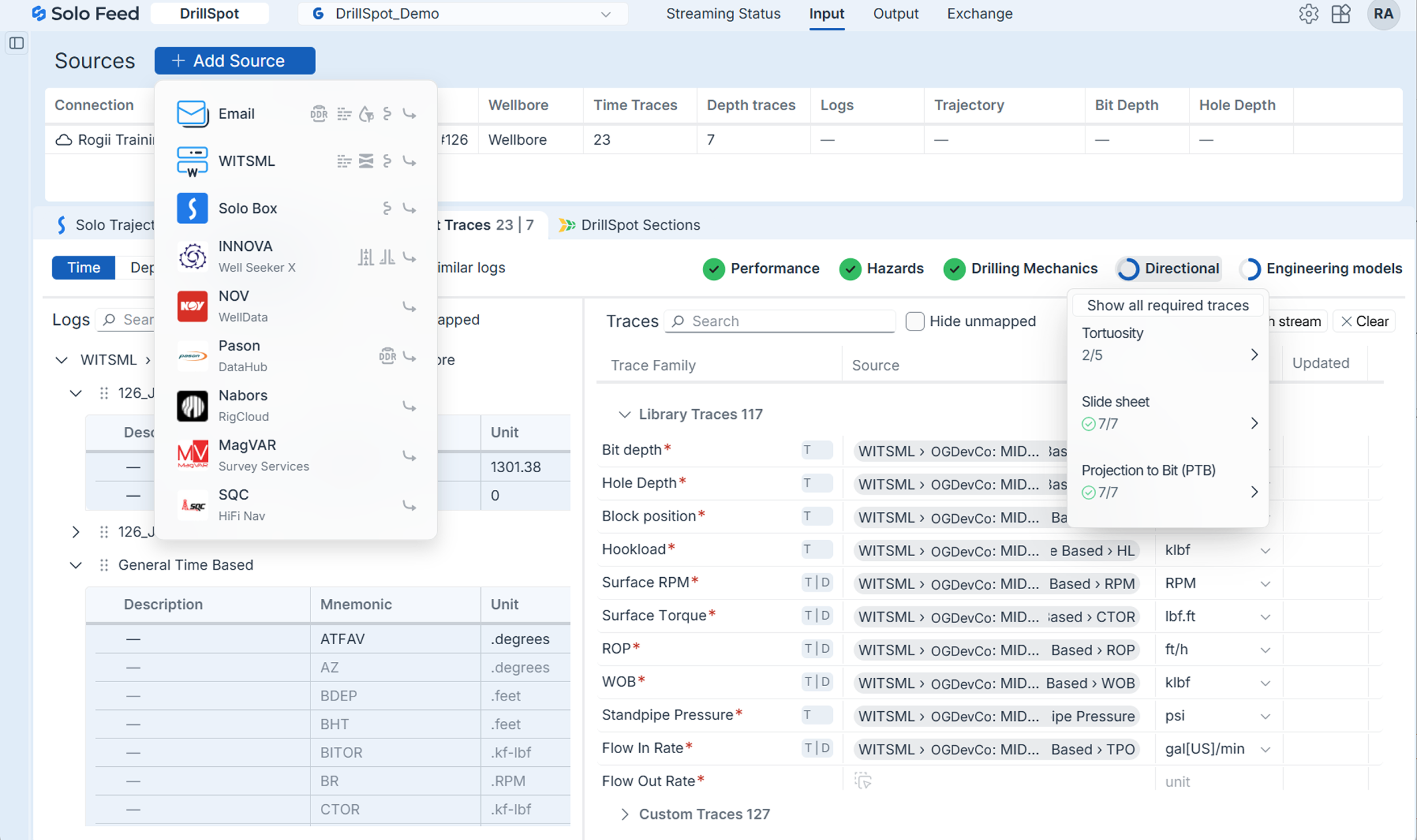
Solo Feed Input lets you configure all rig data sources in one place, so the right streams are connected to the right well every time. Standardize how rig data flows into Solo to keep geosteering and drilling operations reliably fed in real time.
Features:
- Single or multi-well data configuration
- Multiple source types supported
- Centralized source management
- Flexible streaming setup
- Consistent data structure
- Scalable for multi‑well projects
- Future‑proof source expansion
- Foundation for reliable streaming
Geosteering Procedures

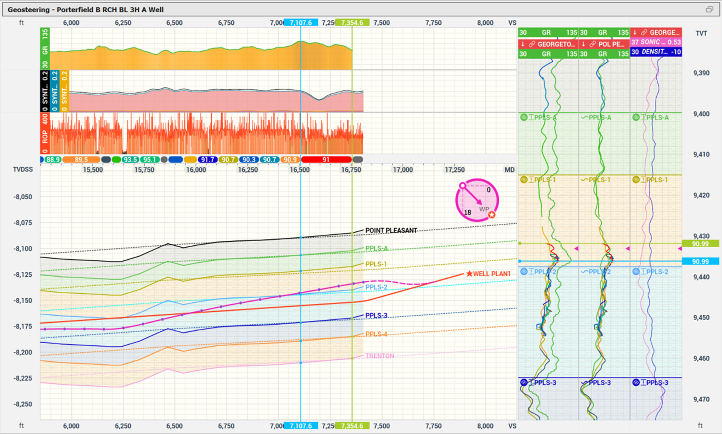
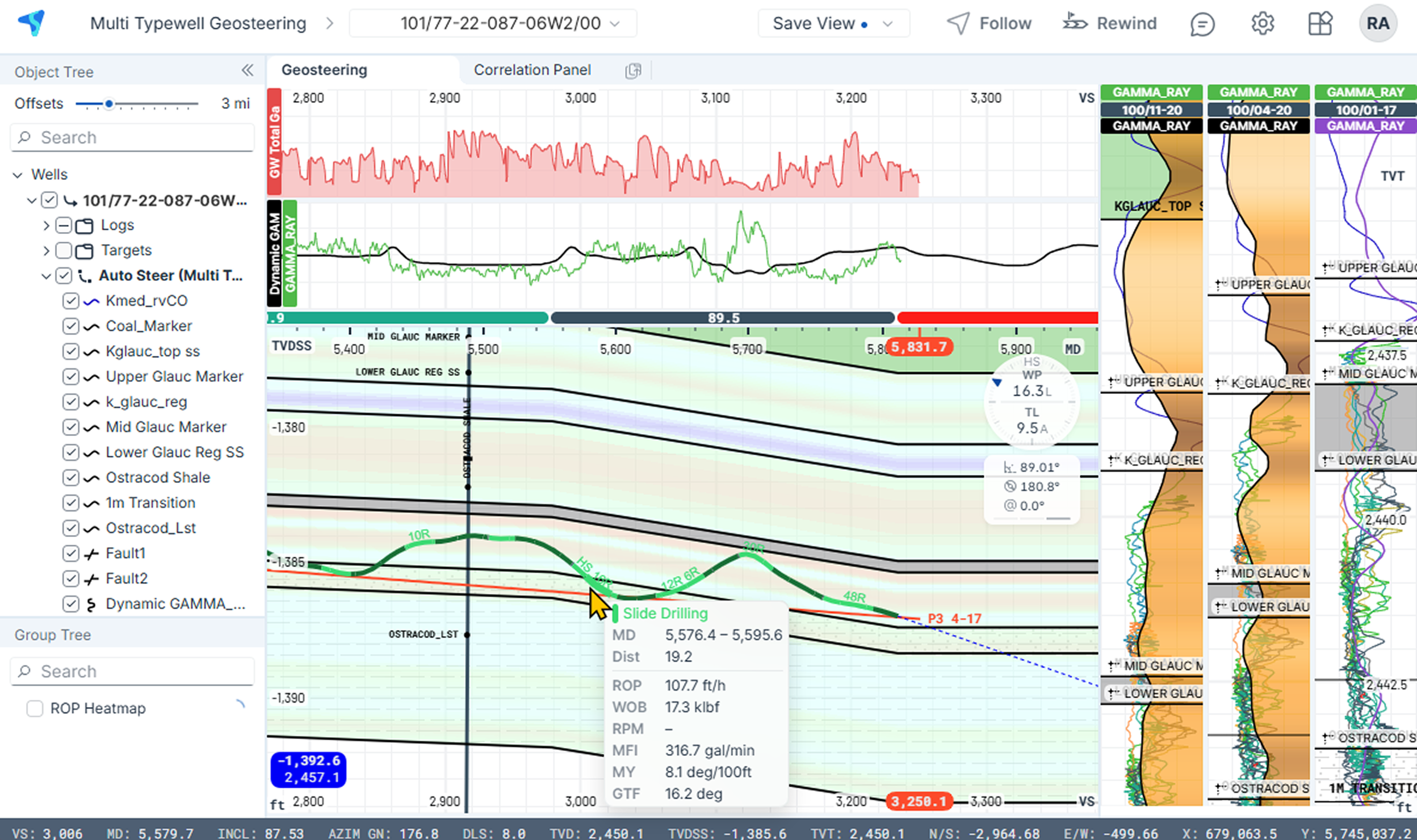
StarSteer’s stratigraphic geosteering capabilities turn complex horizontals into clear, TVT‑based stratigraphic models. Correlate lateral gamma to one or multiple typewells by segmenting, stretching/squeezing, and faulting.
Features:
- TVT‑based vertical projection
- Typewell‑to‑lateral horizon projection
- Multi-typewell geosteering support
- Target line creation with waypoints
- Dynamic dip calculation per segment
- Fault block creation with throw distance
- Thickness Change with geologic controls
- Multi‑scenario interpretations
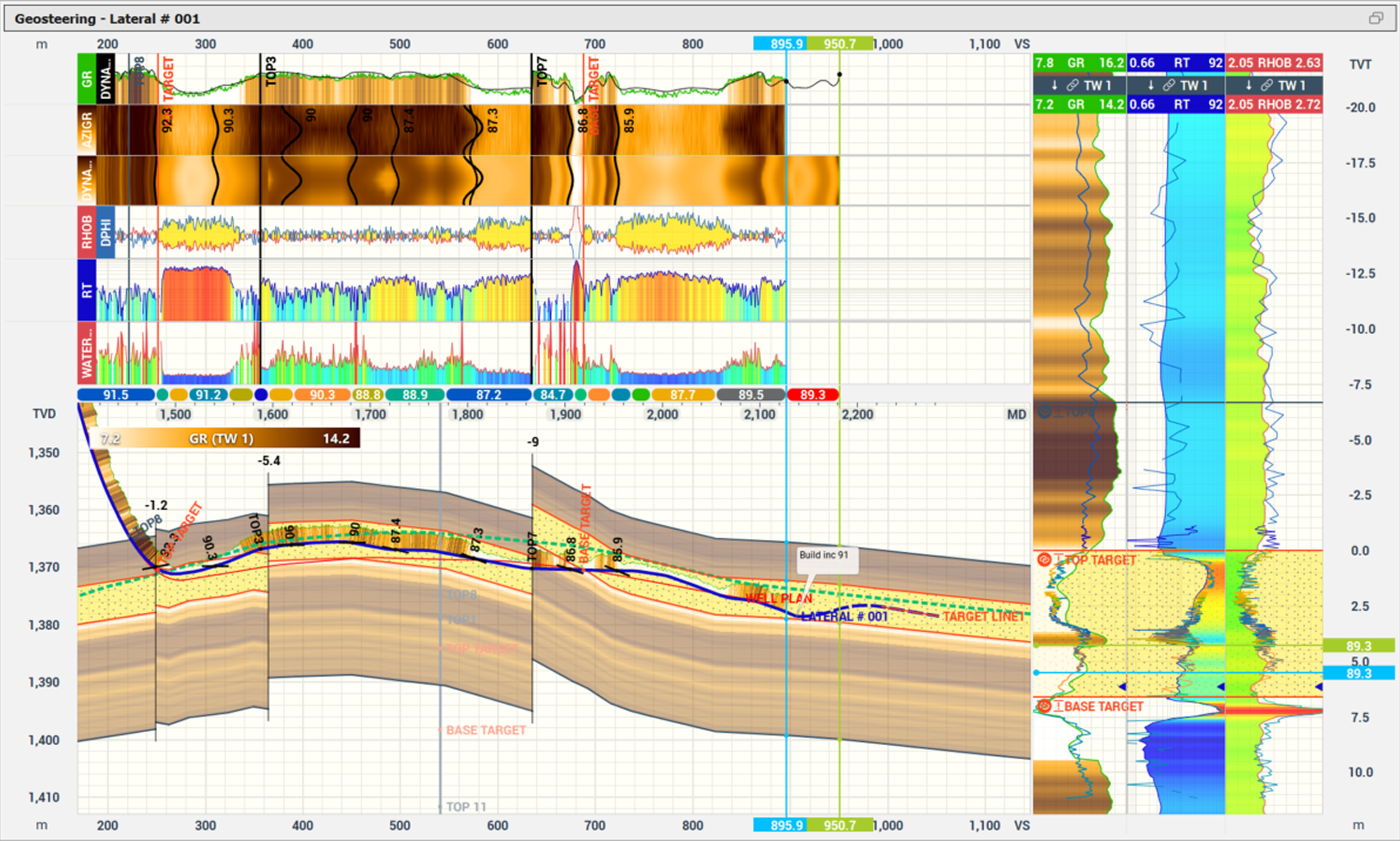
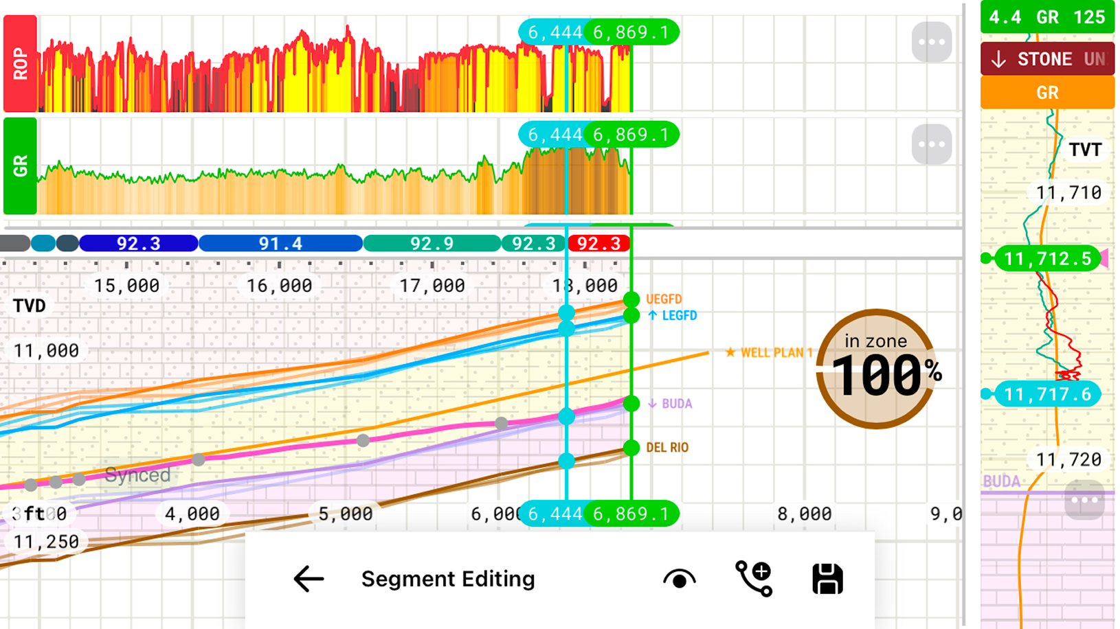
StarSteer’s model based geosteering turns your interpretation into a dynamic model that looks ahead of the bit. Generated synthetic gamma and density logs are dynamic, so you can plan ahead in confidence.
Features:
- Dynamic synthetic gamma log and density log generation
- Endless interpretation beyond the bit
- Dynamic image logs in extensions
- Forward-modeled resistivity
- Interactive fault modeling
- Target line and trajectory projection in model space
- Zone Statistics on the interpreted model
- Model‑aware reporting & interpretation spreadsheet
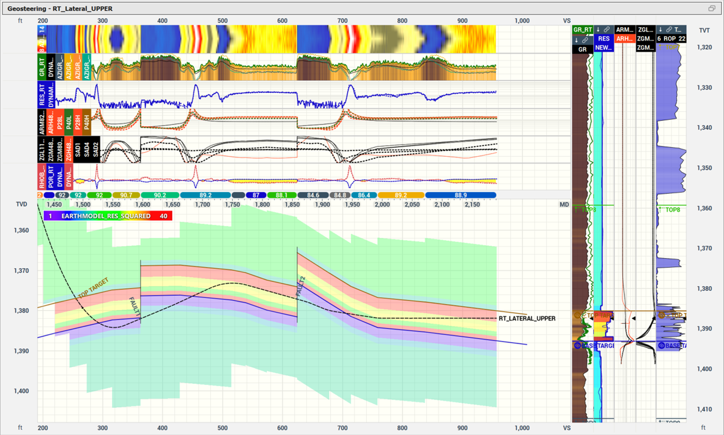
StarSteer Resistivity brings vendor‑independent resistivity modeling and inversion directly into your geosteering workflow. Build pre‑job Earth Models and run ultra‑fast deterministic or stochastic inversions to get distance‑to‑boundary in real time.
Features:
- Pre‑job resistivity modeling in Earth Model
- Fast forward modeling
- Deterministic two‑layer inversion with D2B
- Deterministic Earth Model control & tuning
- Multi‑layer stochastic inversion (P10/P50/P90) from deterministic inputs
- Broad vendor‑independent tool support
- User-defined DAR/UDAR configuration
- Local or Resistivity as a Service (RaaS) HPC processing options
Live Operations Updates


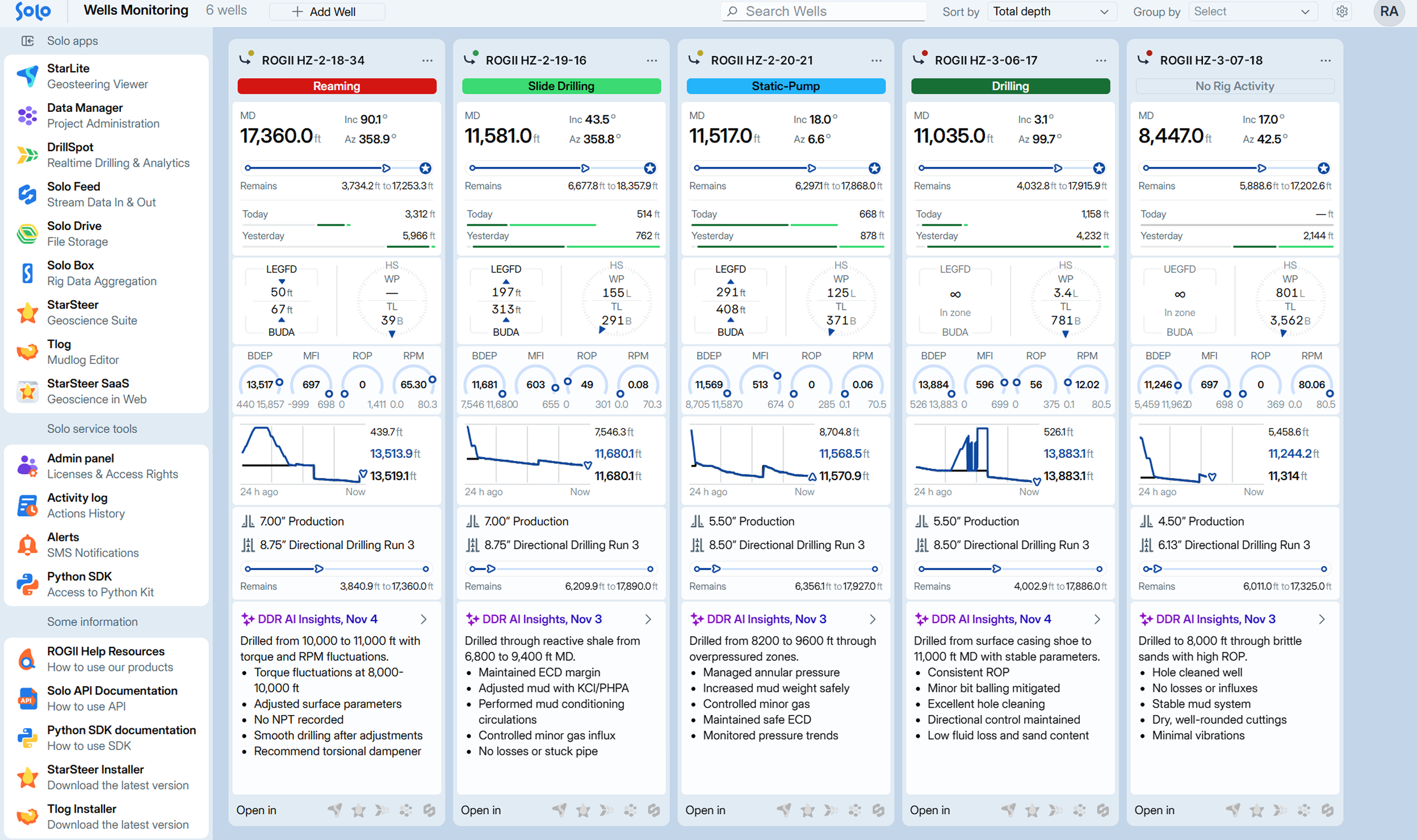
BOSS Dashboard gives users a live, fleet‑wide view of drilling and geosteering performance the moment they log into Solo Cloud. Monitor active wells, track progress and DDR insights, and jump into any Solo app in one click to act fast.
Features:
- Active Well Monitoring Cards
- Add & Organize Wells Easily
- Live Streaming & Drilling Status
- Last Survey & Progress to TD Widgets
- Daily Drilling Report Insights (Pason & Email parsed)
- Operational trend visualizations & performance widgets
- Real-Time Gauge Widgets
- One-Click Access to Apps & Resources
StarLite Web gives your whole team a live window into every well without waiting for daily reports. Geologists, geosteerers, and drilling engineers see the same real‑time view in a browser without needing to open StarSteer.
Features:
- Multi‑typewell geosteering viewer
- Correlation Panel (StarLite Pro)
- Slide Sheet Notations at MD intervals
- Zone Statistics, Time vs. Depth & Distance widgets
- Auto Steer (GaaS) in the browser
- Advanced visualization: seismic, EM, resistivity & mudlogs
- ROP heatmap from offset wells to find sweet spots
- Follow & Rewind modes
StarLite Mobile puts live geosteering in your pocket so you never miss a data push, even when away from the desk. Complete with well cards that show all active wells with performance widgets, an interactive geosteering window, and drilling traces panel, StarLite Mobile is your on-the-go window to your drilling operation.
Features:
- Geosteer on your phone with stretch and squeeze tools
- Mirror of your StarLite “Default View”
- Horizontal & vertical TVT tracks
- Zone & distance statistics widget
- DrillSpot integration for drilling traces
- Portrait & landscape layouts
- Custom vs Default views with log scaling


Collaborative Decision-Making

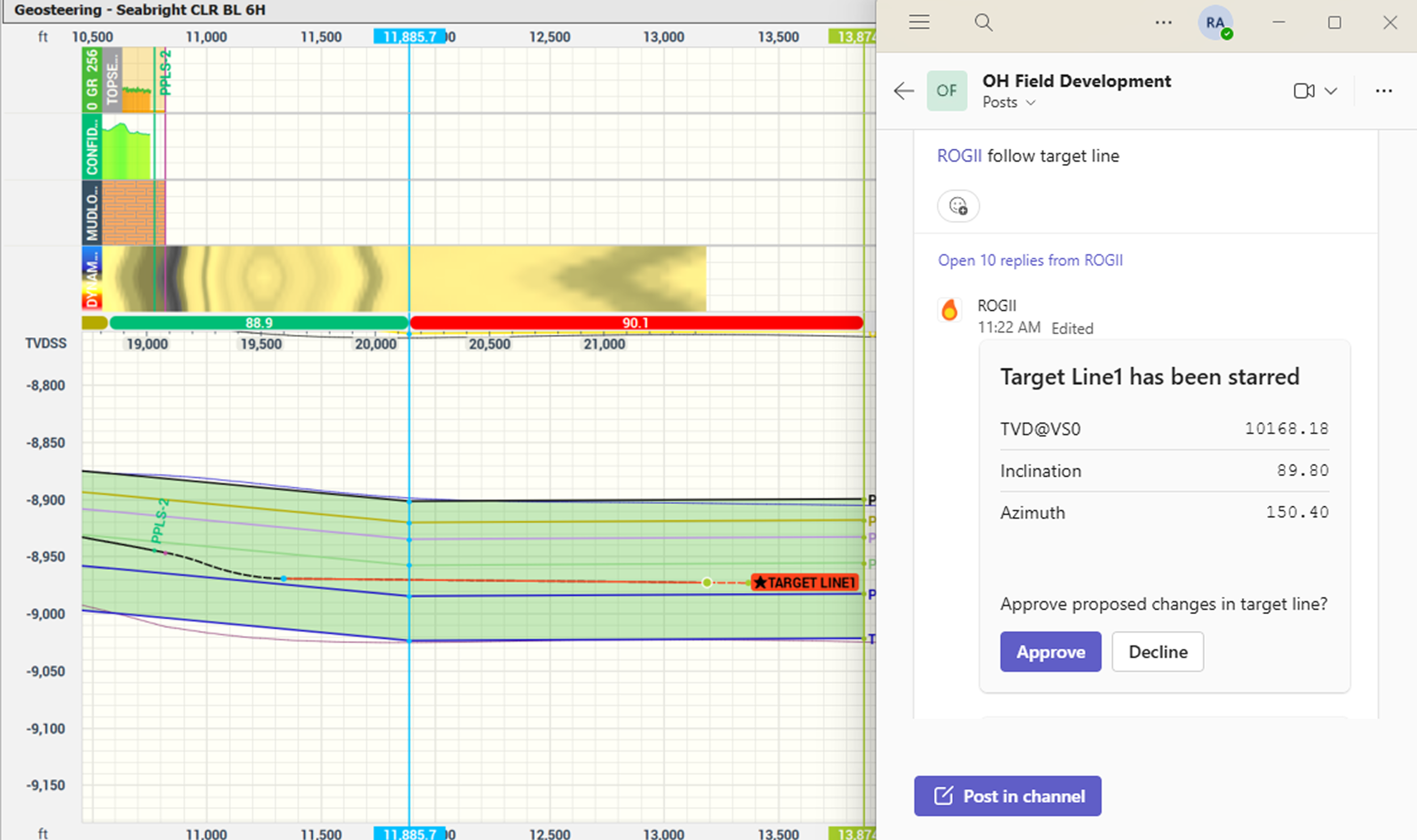
Target Line Integrations keep geology, directional drilling, and operations in sync on every change. Updated target lines in StarSteer flow instantly to Nabors, Innova, and Microsoft Teams, so everyone sees the latest plan.
Features:
- Instantly share target line changes through MS Teams
- Nabors SmartNAV® – optimized trajectory from target line
- Innova Well Seeker X – bidirectional plan exchange
- Real‑time target line sync from StarSteer to Solo products
- Auto‑update vs manual target line handling (Innova)
- Automatic plan management per target line (Innova)
- Shared geological context with directional systems
- Automated API‑based sharing of target lines
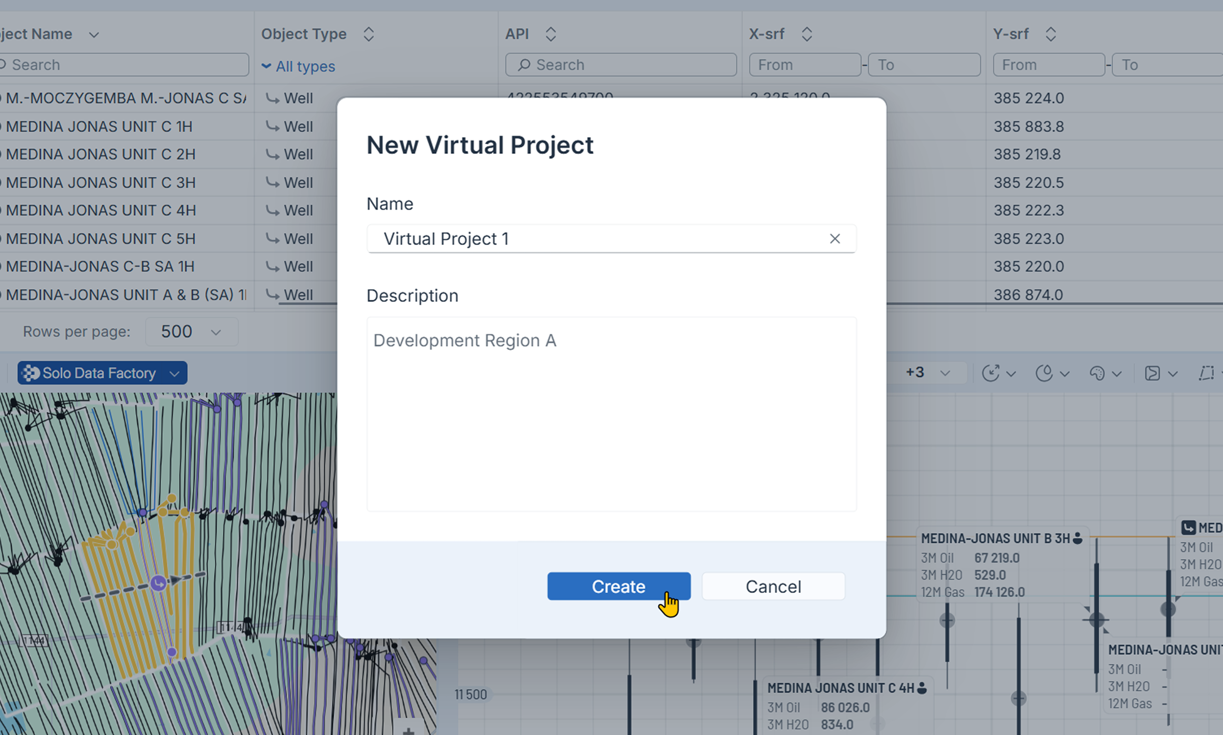
Solo Cloud lets operators and service companies collaborate on the same live data without sacrificing control. Virtual projects, roles, and private interpretations let vendors contribute while only seeing what they need.
Features:
- Create virtual projects for each service provider
- Granular role‑based access control
- Multiple interpretation support per well
- Private and shared interpretations
- Real‑time shared view in StarLite Web & Mobile
- Live activity history and Rewind for audits
- Integrated encrypted chat & automated alerts
- Open public API & Solo Connect for data exchange
Key Benefits
Standardized Quality
Normalize data across vendors with consistent, trusted inputs
Real-Time Updates
View well progress instantly without waiting for static reports
Operational Awareness
Sync target line changes across teams and service companies
Controlled Access
Ensure data privacy with extensive permission controls
Why Choose Solo Cloud?

ROGII’s Technical Analysts are available 24/7 for support and workflow advice
Cloud Storage
SOC2 certified cloud storage and role based access safeguards your projects
Continuity
Projects are always protected and recoverable in Solo Cloud
Ecosystem
Solo Cloud products link planning, geosteering, & drilling tools in one environment


